Property Record
3446 Winder Hwy, Flowery Branch, GA 30542
NEARBY LISTINGS FOR SALE OR LEASE
Property Detail
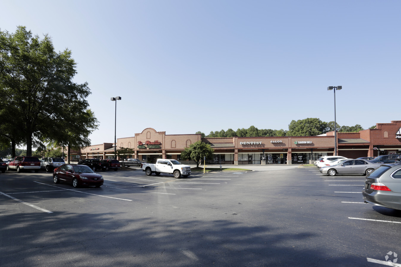
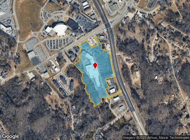
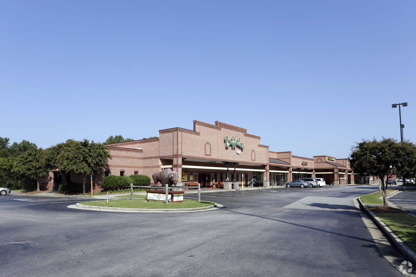
3446 Winder Hwy
15-00045-00-010
Cedar Ridge Dev Co
Stripcommercialcenter
WINDER HIGHWAY
X
Hall
13013C0025D
Georgia
2024
15.90 AC
2024
Gainesville/Hall Cnty
001404
Atlanta
95,843 SF
Gainesville, GA
DEMOGRAPHICS near 3446 Winder Hwy
1 Mile
3 Mile
5 Mile
2024 Total Population
4,199
29,325
75,948
2029 Population
4,702
32,913
84,710
Pop Growth 2024-2029
+ 11.98%
+ 12.24%
+ 11.54%
Average Age
37
37
38
2024 Total Households
1,525
10,228
25,729
HH Growth 2024-2029
+ 11.87%
+ 12.17%
+ 11.60%
Median Household Inc
$57,645
$66,809
$66,208
Avg Household Size
2.70
2.80
2.90
2024 Avg HH Vehicles
2.00
2.00
2.00
Median Home Value
$256,474
$251,304
$261,539
Median Year Built
1999
2000
1997
Nearby Places
- Restaurants
- Banks
- Shops
- Fitness
- Groceries
PUBLIC TRANSPORTATION
COMMUTER RAIL
Gainesville Amtrak Station (Crescent - Amtrak)
DRIVE
WALK
Distance
Gainesville Amtrak Station (Crescent - Amtrak)
10 min
6.4 mi
Freight Ports
Georgia Ports - Savannah
DRIVE
WALK
Distance
Georgia Ports - Savannah
319 min
253.2 mi
SALE & LEASE HISTORY
LISTING DATE
SALE/LEASE

Sep 25, 2016
For Lease
Jul 31, 2018
For Lease
Nearby Properties
Address
Land Use
TOTAL SIZE
Lot Size
Zoning
Address
Land Use
TOTAL SIZE
Lot Size
Zoning
656,200 SF
70.29 AC
M-1
Address
Land Use
TOTAL SIZE
Lot Size
Zoning
150,738 SF
43.34 AC
M-1
Address
Land Use
TOTAL SIZE
Lot Size
Zoning
164,815 SF
29.93 AC
R-IV
Address
Land Use
TOTAL SIZE
Lot Size
Zoning
92,448 SF
24.25 AC
PUD
Address
Land Use
TOTAL SIZE
Lot Size
Zoning
342,720 SF
22.95 AC
PUD
Address
Land Use
TOTAL SIZE
Lot Size
Zoning
144,744 SF
35.47 AC
C-II
Address
Land Use
TOTAL SIZE
Lot Size
Zoning
4,511 SF
15.85 AC
PUD
Address
Land Use
TOTAL SIZE
Lot Size
Zoning
760,440 SF
53.33 AC
L-I
Address
Land Use
TOTAL SIZE
Lot Size
Zoning
3,881 SF
27.86 AC
R-IV
Address
Land Use
TOTAL SIZE
Lot Size
Zoning
174,720 SF
50.23 AC
M-II
Address
Land Use
TOTAL SIZE
Lot Size
Zoning
277,684 SF
23.06 AC
L-I
Address
Land Use
TOTAL SIZE
Lot Size
Zoning
104,340 SF
42.22 AC
INST
Address
Land Use
TOTAL SIZE
Lot Size
Zoning
346,875 SF
82.09 AC
H-I
Address
Land Use
TOTAL SIZE
Lot Size
Zoning
351,550 SF
26.91 AC
M-II
Address
Land Use
TOTAL SIZE
Lot Size
Zoning
225,378 SF
24.42 AC
M-1
Address
Land Use
TOTAL SIZE
Lot Size
Zoning
23,052 SF
6.99 AC
PRD
Address
Land Use
TOTAL SIZE
Lot Size
Zoning
3,195 SF
80.04 AC
AR-III
Address
Land Use
TOTAL SIZE
Lot Size
Zoning
515,468 SF
92 AC
I-I
Address
Land Use
TOTAL SIZE
Lot Size
Zoning
308,672 SF
41.22 AC
L-I
Address
Land Use
TOTAL SIZE
Lot Size
Zoning
201,322 SF
10 AC
M-I
Address
Land Use
TOTAL SIZE
Lot Size
Zoning
440,000 SF
15.60 AC
M-I
Address
Land Use
TOTAL SIZE
Lot Size
Zoning
141.54 AC
R-I
Address
Land Use
TOTAL SIZE
Lot Size
Zoning
87,714 SF
18.98 AC
C-II
Address
Land Use
TOTAL SIZE
Lot Size
Zoning
148,068 SF
31.65 AC
M-I
Address
Land Use
TOTAL SIZE
Lot Size
Zoning
1,920 SF
10.31 AC
H-B
Address
Land Use
TOTAL SIZE
Lot Size
Zoning
16,560 SF
9.62 AC
PRD
Address
Land Use
TOTAL SIZE
Lot Size
Zoning
45,986 SF
28.83 AC
H-B
Address
Land Use
TOTAL SIZE
Lot Size
Zoning
102,996 SF
10.94 AC
L-I
Address
Land Use
TOTAL SIZE
Lot Size
Zoning
287,366 SF
61.55 AC
I-II
Address
Land Use
TOTAL SIZE
Lot Size
Zoning
172,114 SF
43.32 AC
M-I
The World's #1 Commercial Real Estate Marketplace
Connect with us
© 2025 CoStar Group
The information above has been obtained from sources believed reliable. While we do not doubt its accuracy we have not verified it and make no guarantee, warranty or representation about it. It is your responsibility to independently confirm its accuracy and completeness. Any projections, opinions, assumptions, or estimates used are for example only and do not represent the current or future performance of the property. The value of this transaction to you depends on tax and other factors which should be evaluated by your tax, financial, and legal advisors. You and your advisors should conduct a careful, independent investigation of the property to determine to your satisfaction the suitability of the property for your needs.